This new scientific publication, led by the Volcanological Institute of the Canary Islands, highlights the international collaborative work on the study of the Tajogaite eruption on La Palma, which occurred in 2021.
The new scientific publication on the Tajogaite eruption (La Palma, Canary Islands, Spain) led by the Volcanological Institute of the Canary Islands (INVOLCAN) is the result of a multidisciplinary effort involving leading researchers from the National Institute of Geophysics and Volcanology (INGV, Italy), the University of Geneva (Switzerland), the University of Manchester (UK), the University of Pisa (Italy) and the Institute of Technology and Renewable Energy (ITER).
The research, entitled “Towards rapid integrated data acquisition and management during a volcanic crisis: the 2021 Tajogaite eruption of Cumbre Vieja (La Palma, Canary Islands)”, has been published in Volcanica, an international open access scientific journal that promotes research in volcanology, including its impacts on society, health and the environment.
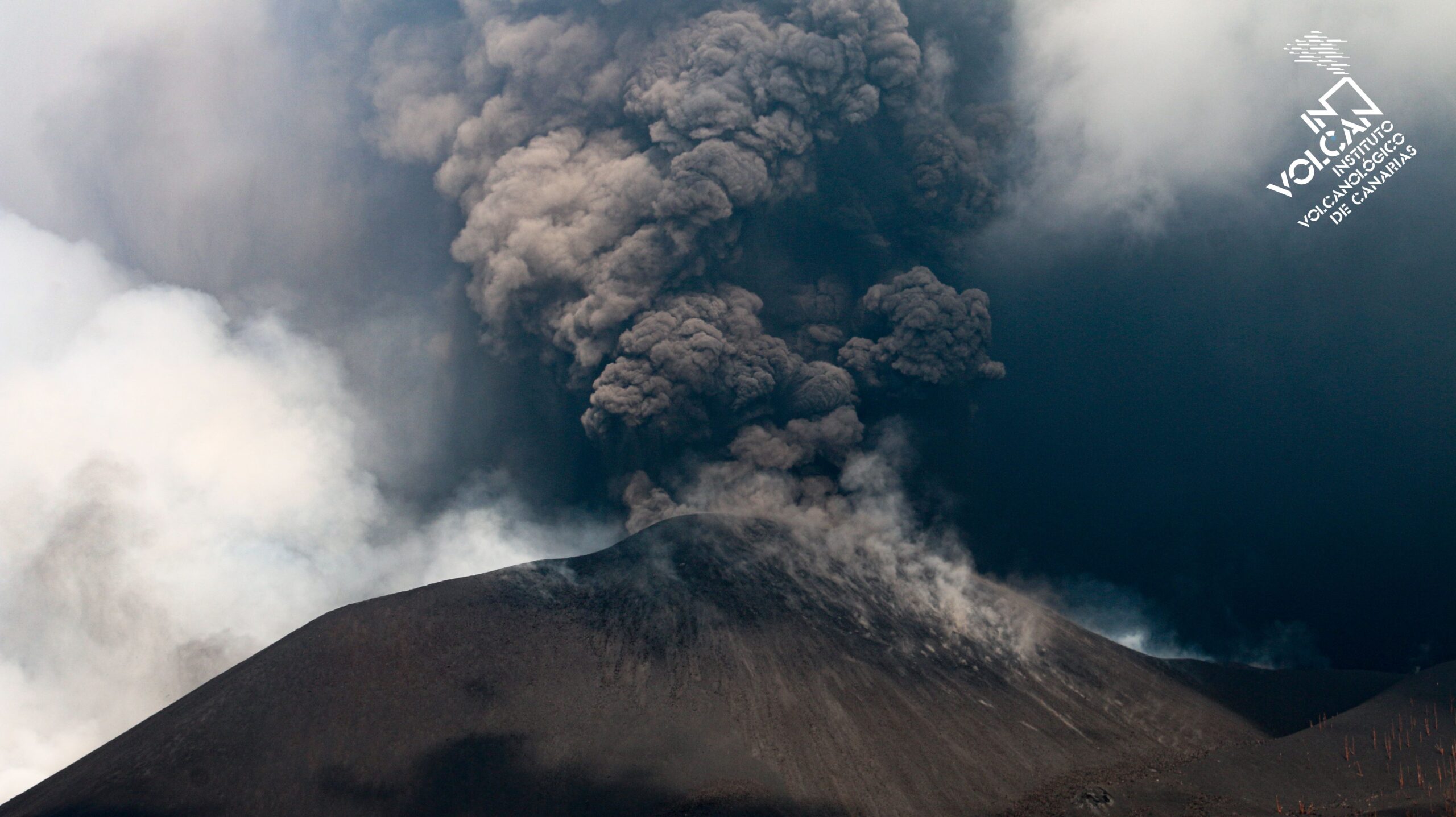
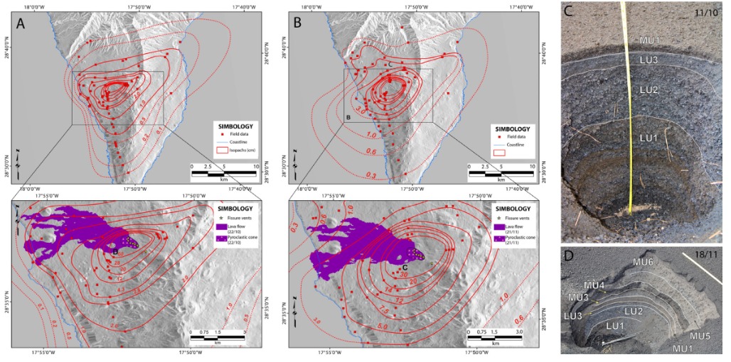
This study represents a remarkable joint effort between international scientific teams, underscoring the importance of collaboration in managing and understanding volcanic crises. During the Cumbre Vieja eruption, the teams performed a detailed analysis of tephra deposits in a stratigraphic framework, providing a comprehensive view of volcanic phenomena in real time.
What are trefa deposits?
Tephra refers to solid material ejected into the air during a volcanic eruption and then falling to the ground. It can include rock fragments, volcanic ash, lapilli (intermediate-sized fragments) and larger volcanic bombs. These deposits are of great scientific importance, since their analysis makes it possible to reconstruct the history of the eruption, to understand the processes occurring inside the volcano and to assess the impact of the fall of material on the ground and populations.
In this case, the researchers developed a detailed stratigraphy of the tephra deposits, including three main units, and correlated various layers based on marker horizons, granulometry and components, which allowed a detailed understanding of the eruptive dynamics and changes in the volcano’s activity.
Impact of results
The collection and analysis of data from various disciplines enabled civil protection authorities to make informed decisions during the crisis.
The continuous production of tephra during the eruption provided valuable information on the evolution of volcanic activity and its impact on the environment and society.
This work has also allowed correlating the temporal observations of the eruptive style with the geophysical records obtained, which contributes to the understanding of the eruption and the changes in the dynamics of the eruptive column.
A highlight was the ability of the PEVOLCA Directorate to inform the population about changes in the magnitude of the eruption, moving from a Volcanic Explosivity Index (VEI) of 2 to 3, which helped manage the crisis effectively.
Access to the article:
The researchers’ article, led by Rodriguez F., Coldwell B., Martin-Lorenzo A., Andronico D., Bonadonna C., and other collaborators, is available in Volcanica (2024, 7(2), pp. 891-905) https://doi.org/10.30909/vol.07.02.891905.