These systems are of interest for the development of R&D projects at ITER such as the PERSEO project.
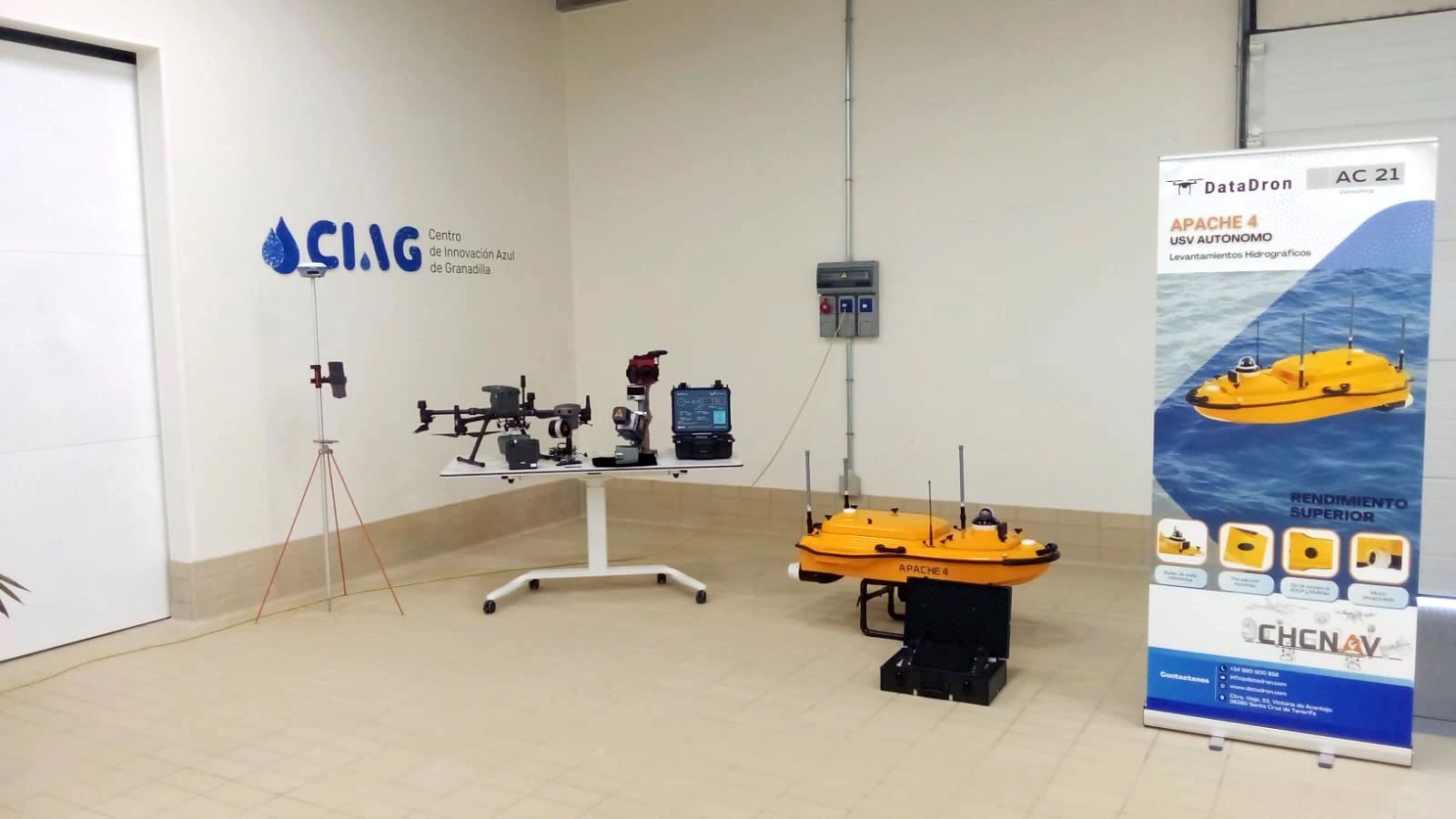
The presentation event organized by Datadron and CHCNAV was held at the Port Inspections Center (CIAG) of the Granadilla de Abona Port, enabling researchers from ITER to establish contact with CHCNAV and Datadron companies. The event served as a platform for researchers to showcase the R&D work being carried out at ITER and to lay the groundwork for future collaboration or synergies between the entities.
These aerial systems are of interest to the Robotics and Automation group at ITER as they align with the R&D projects they are developing, such as the PERSEO project. The PERSEO project aims to monitor the marine ecosystem through the processing of multispectral images collected with a solar aerial platform.
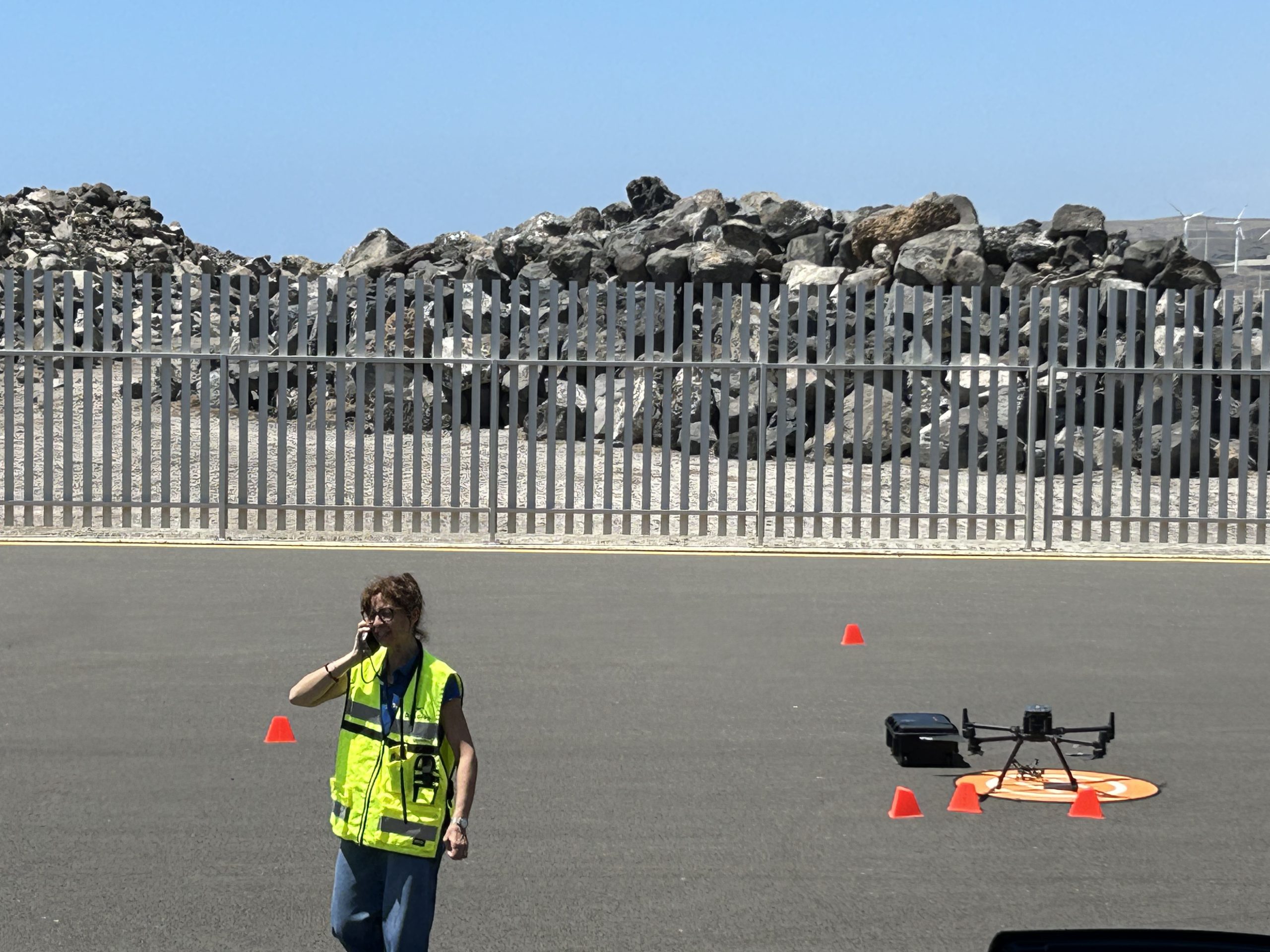
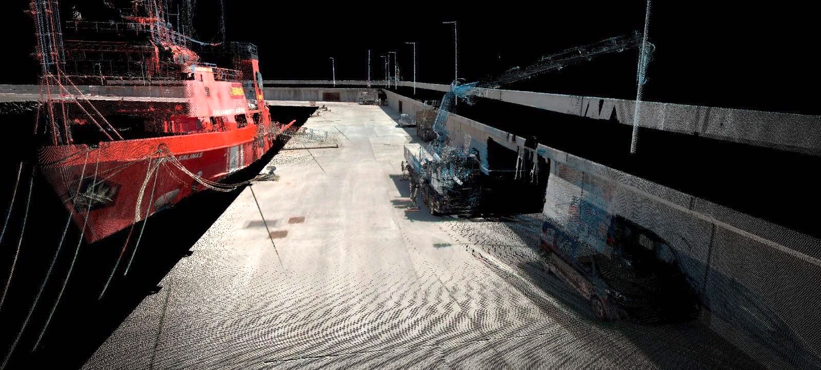
During the event, new models of high-precision LIDAR sensors for drones were presented, along with the autonomous marine surface vehicle (USV), Apache 4 model. Demonstrations were conducted for both the integration and flight of drones with these sensors for image capture of the port area, as well as for the autonomous marine surface vehicle to collect underwater bathymetry data. Subsequently, data reconstruction and visualization of the results were demonstrated.
CHC Navigation – CHCNAV is a globally recognized company known for its rapid growth in Geomatics Technologies. It specializes in innovative GNSS navigation and positioning solutions, with products and solutions spanning multiple industries such as geospatial, construction, agriculture, and marine. DATADRON, a collaborative partner of CHCNAV in Spain, is a drone company specialized in pilot training as well as the acquisition and analysis of sensor data from autonomous vehicles.