Desarrollo de un avión solar teledirigido para misiones de vigilancia
Detalles
Acrónimo: HELIODRON
Socios: Instituto Tecnológico y de Energías Renovables, Fundación Centro Tecnológico de Componentes (CTC) y Aerosertec
Duración: 2016-2018 (27 meses)
Presupuesto: 775.542,10€
Financiación: Retos-Colaboración Programme. R+D National Plan 2013-2016. Economy and Competitiveness Ministry. FEDER funds.

Resumen del proyecto
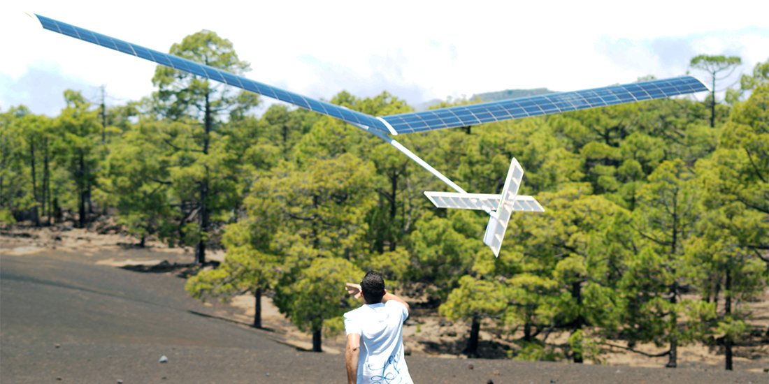
El principal objetivo del proyecto HELIODRON es desarrollar una aeronave solar pilotada por control remoto de 2 metros de envergadura que estará equipada con instrumentación específica para realizar diferentes misiones de vigilancia. Será útil no sólo para la prevención, sino también para la gestión de incidentes y catástrofes que puedan producirse.
Las ventajas de este tipo de aeronaves frente a otros sistemas de vigilancia son principalmente su bajo coste de fabricación y explotación, su rápida disponibilidad y su gran autonomía.
La solución adoptada de antemano es un avión solar de 2 metros de envergadura, diseñado para una altitud de vuelo de hasta 3.000 metros y una velocidad operativa máxima de 20 m/s con rápida disponibilidad.
Además del prototipo de avión solar, durante el proyecto también se desarrollará la instrumentación específica necesaria para llevar a cabo la misión de vigilancia. Cabe señalar que el proyecto requiere desarrollos específicos para responder a las peculiaridades de la energía solar, que permite una mayor autonomía de vuelo, esencial en este tipo de misiones de vigilancia, al tiempo que impone condiciones restrictivas de peso y consumo de energía a todos los equipos de a bordo.
El consorcio comprometido para el desarrollo del proyecto HELIODRON está integrado por el ITER, la Fundación Centro Tecnológico de Componentes (CTC) y Aerosertec.
CTC será responsable del desarrollo de un sistema de navegación redundante de bajo coste, tamaño compacto y bajo consumo, que ofrecerá mayor precisión que los sistemas comerciales más costosos. En cuanto a las aeronaves solares para la vigilancia y gestión de desastres, el sistema de navegación propuesto supone una mejora significativa respecto al uso de un sistema comercial de bajo coste, ya que también aumenta la integridad, la precisión y la disponibilidad de la solución en cualquier circunstancia. Esto se traduce directamente en una mejor geolocalización de puntos singulares, lo que proporciona una respuesta rápida y una mejor gestión de los recursos disponibles para los servicios de emergencia.
Aerosertec será la encargada del diseño estructural de la aeronave, que en este caso concreto requiere materiales extremadamente ligeros y robustos.
Los miembros del consorcio esperan generar al menos 2 patentes, 2 empleos directos y 4 indirectos con el desarrollo del proyecto.